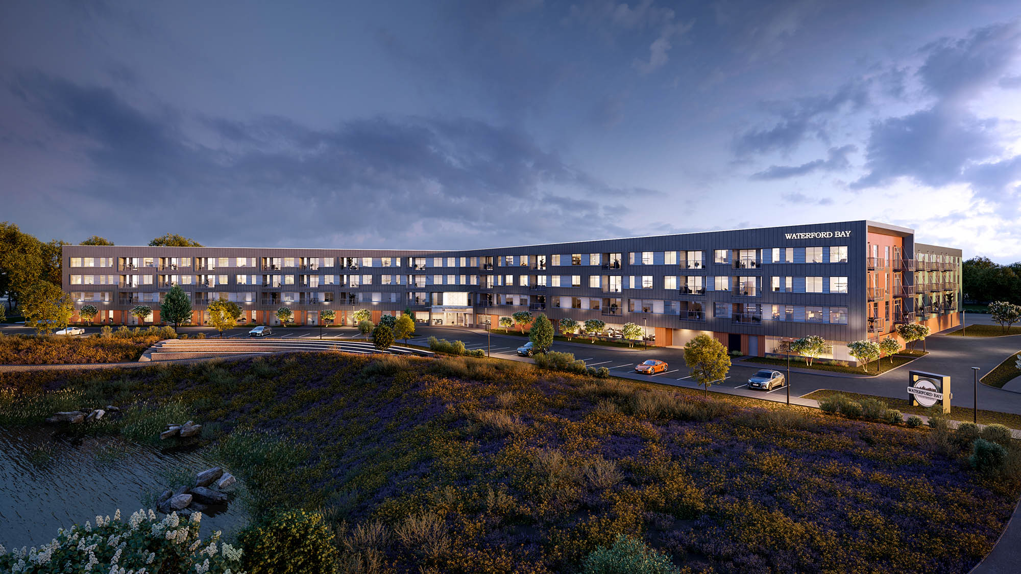
Apartment proposal at former Island Station power plant promises Mississippi River access
Twin Cities Pioneer Press | Frederick Melo | May 26, 2019
Ryan Swingruber said he has big plans for the former Island Station site in St. Paul, but not too big.
The 10-acre parcel of land bordering the Mississippi River near Shepard Road and Randolph Avenue has sat vacant since 2014, and previously was home to a coal-fired power plant decommissioned in the 1970s.
By September, he hopes to break ground on three and four stories of rental housing — a mix of micro, studio, one-bedroom and two-bedroom apartments.
Working with a series of environmental consultants and architects, the Chicago-area developer drew up plans for 250 market-rate apartments, stepped back from the river.
Swingruber’s vision, set within a federal “Opportunity Zone,” calls for a multi-family housing complex that he said will increase rather than block river access.
Those plans include paved walking and biking paths to an inlet, a proposed public kayak launch and connections from the regional trail system along Randolph Avenue.
“From there, they’ll be able to traverse the peninsula,” said Swingruber, who has been meeting with Xcel Energy, which owns land on either side of the future development. “We want to make it public, with defined access and signage.”
The West 7th/Fort Road Federation voted to support the project’s conditional-use permit in March, but also included a letter to the city’s zoning committee raising two concerns. The federation sought deeper assurances the project would include improved public access to the river, and raised questions about the lack of affordable units.
“The Federation Board is being asked, once again, to support a market-rate housing project in our district,” said the letter, signed by board president Dana DeMaster. “We have a need for affordable housing, especially for families and for elderly persons, and this project proposal will not meet that need.”
She noted that the West Seventh neighborhood has among the highest average rents in St. Paul, and experienced a 17 percent increase in rental costs since 2010.
Swingruber said he’s also met with the Friends of the Mississippi River and, in response to their concerns, the building height will drop from four to three stories nearest the riverfront.
“We’ve seen some past development proposals that haven’t gone anywhere,” said Colleen O’Connor Toberman, river corridor program director with Friends of the Mississippi River. “From what we’ve seen of the developer’s plans, there are some nice components of community access to the riverfront, and we do appreciate that aspect of the plan.”
ISLAND STATION BLOWN APART
The site was once home to the Island Station coal-based power plant, an unofficial St. Paul landmark that drew its share of cheers and jeers before it was blown to smithereens.
At St. Paul City Hall, efforts to declare the decommissioned 1920s-era power plant a local historic site deadlocked with a tie vote before the city council in 2013, sealing its fate. Developers literally exploded the iconic but decrepit structure the following March.
As the 280-feet-tall metal smokestack collapsed into debris, hopes for new residences, retailers and other fresh real estate gained some ground.
Fast forward five years, and no one has built anything. After nearly 45 years in limbo, however, the Island Station property has once again caught the eye of a prospective buyer.
Swingruber, a vice president with the Stoneleigh Cos. of Barrington, Ill., hopes to add housing to the site under the title Waterford Bay. This will be the first Twin Cities development for the company, which has apartment properties throughout Texas.
On Thursday, the St. Paul Planning Commission’s zoning committee reviewed a request from the Stoneleigh Cos. to construct the 45-feet-tall apartment complex. Anything above 35 feet triggers the need for a conditional-use permit.
In addition, the main entrance would be situated facing the river on the east side of the property, rather than in the third of the building closest to Randolph Avenue, as currently required.
The developer has also proposed a fire access road and storm sewers in the floodway plain, as well as variances for a front yard setback.
Swingruber said the building will be set back 100 feet from the river, rather than 50, as presently required, in respect for the proposed river setbacks in the city’s draft 2040 Comprehensive Plan. It will be three stories tall closest to the river, and four stories closer to Randolph Avenue, creating a stepped-back approach from the waterfront.
The “Traditional Neighborhood” or “T2” zoning would allow a maximum of 375 housing units, but Swingruber plans to build two-thirds as many units so as not to overwhelm the site.
Given the site’s history as a coal-fired plant, the project will require carefully addressing contaminated soils. Swingruber said he’s worked closely with environmental consultants Braun Intertec, design engineering consultants Kimley-Horn and architects with the BKV Group.
The site sits within a federally designated “Opportunity Zone,” which allows certain tax benefits for investors who hold onto properties for at least 10 years.
In an interview, city council member Rebecca Noecker said she looked forward to a briefing from St. Paul Planning and Economic Development.
FALSE STARTS
A previous developer, T.J. Hammerstrom, once planned 240 units of townhomes and condominiums on the site and in an adjoining eight-story building, which were never constructed.
In late 2014, after the power plant was demolished, Breckner River Development of Burnsville sold the site to Riverwalk of Scottsdale, Ariz., for $4.5 million.
The plot of land at 380 Randolph Ave. generates about $70,000 to $75,000 in property tax and special assessments annually. The listed property owner, St. Paul Riverwalk LLC, owes $343,000 in back taxes, according to Ramsey County property records.
According to the county, the land has an estimated market value of roughly $2 million.

